| From left to right: Me, Donna, and Sharon. This was taken by Rob Tyler. |
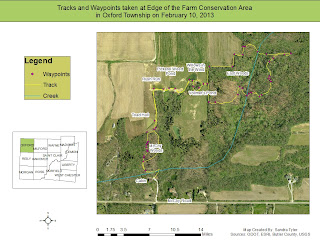
On this lovely winter day, I took GPS points with a Garmin 62 while walking throughout EFCA and taking lots of notes. These points, known as "waypoints", were then downloaded with the "track" and put into ArcGIS and made into a map. The "track" is the path that I walked while using the GPS.
 |
| The first trail map of EFCA. |
I am currently working on adding the parcel data to this map so that the boundaries of EFCA are included. After this is finished, a map showing hydrology will be made as well as one showing topography. There may be more maps created, but those are some of the major ones that need to be made because the topography drastically changes throughout EFCA and the hydrology is very interesting due to the impact of glaciation. There will be more on that in another blog.
No comments:
Post a Comment